
Cooperative Localization for Connected Autonomous Vehicles Utilizing LiDAR-Equipped Infrastructure
, Mar 30, 2024
Summary in three lines
- LiDAR map matching can become unreliable where detailed maps or distinctive landmarks are missing.
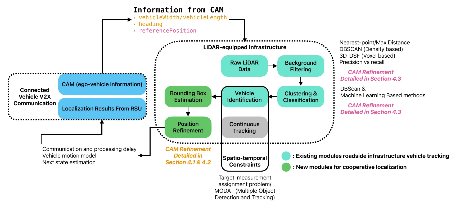
- The thesis uses roadside LiDAR to observe vehicles and send additional localization information over V2I.
- It evaluates how the infrastructure-assisted approach supplements vehicle-based localization.
Figures from the paper
Abstract
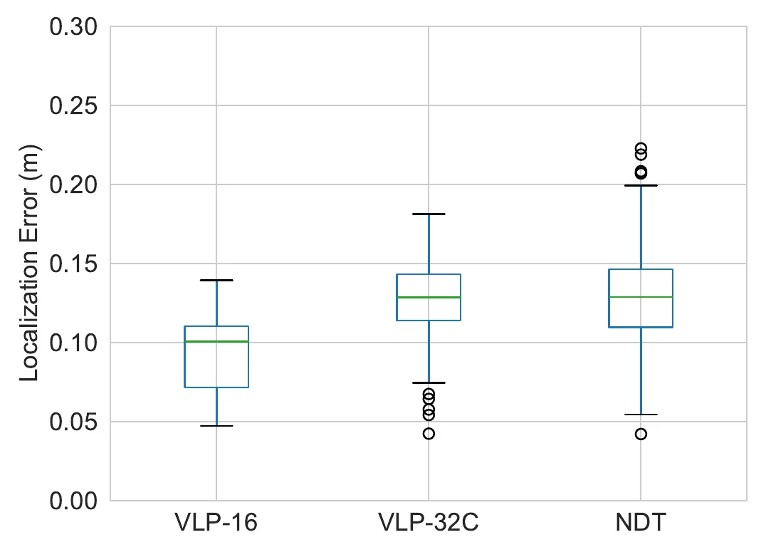
Advancements in LiDAR technology have led to more cost-effective production while simultaneously improving precision and resolution. As a result, LiDAR has become in- tegral to vehicle localization, achieving centimeter-level accuracy through techniques like Normal Distributions Transform (NDT) and other advanced 3D registration algorithms. Nonetheless, these approaches are reliant on high-definition 3D point cloud maps, the cre- ation of which involves significant expenditure. When such maps are unavailable or lack sufficient features for 3D registration algorithms, localization accuracy diminishes, posing a risk to road safety. To address this, we proposed to use LiDAR-equipped roadside unit and Vehicle-to-Infrastructure (V2I) communication to accurately estimate the connected autonomous vehicle’s position and help the vehicle when its self-localization is not accu- rate enough. Our simulation results indicate that this method outperforms traditional NDT scan matching-based approaches in terms of localization accuracy.
How to cite
Y. Jiang, “Cooperative Localization for Connected Autonomous Vehicles Utilizing LiDAR-Equipped Infrastructure,” in , 2024.
BibTeX
@mastersthesis{Jiang2024,
  title         = {Cooperative Localization for Connected Autonomous Vehicles Utilizing LiDAR-Equipped Infrastructure},
  author        = {Yuze Jiang},
  year          = {2024},
  date          = {2024-03-30},
  urldate       = {2024-03-31},
  abstract      = {Advancements in LiDAR technology have led to more cost-effective production while simultaneously improving precision and resolution. As a result, LiDAR has become in- tegral to vehicle localization, achieving centimeter-level accuracy through techniques like Normal Distributions Transform (NDT) and other advanced 3D registration algorithms. Nonetheless, these approaches are reliant on high-definition 3D point cloud maps, the cre- ation of which involves significant expenditure. When such maps are unavailable or lack sufficient features for 3D registration algorithms, localization accuracy diminishes, posing a risk to road safety. To address this, we proposed to use LiDAR-equipped roadside unit and Vehicle-to-Infrastructure (V2I) communication to accurately estimate the connected autonomous vehicle’s position and help the vehicle when its self-localization is not accu- rate enough. Our simulation results indicate that this method outperforms traditional NDT scan matching-based approaches in terms of localization accuracy.},
  keywords      = {ITS, Thesis},
  pubstate      = {published},
  tppubtype     = {mastersthesis}
}