
4D Path Planning via Spatiotemporal Voxels in Urban Airspaces
3rd Annual IEEE International Conference on Metaverse Computing, Networking, and Applications (MetaCom 2025), Seoul, Korea, Aug 27, 2025
DOI: 10.1109/MetaCom65502.2025.00022
Summary in three lines
- The paper represents urban low-altitude airspace as spatial voxels that change over time.
- It uses PLATEAU city geometry and trains a controller to plan around static and moving obstacles.
- Experiments on a Shinjuku scene compare the approach with conventional planning on safety and efficiency.
Figures from the paper
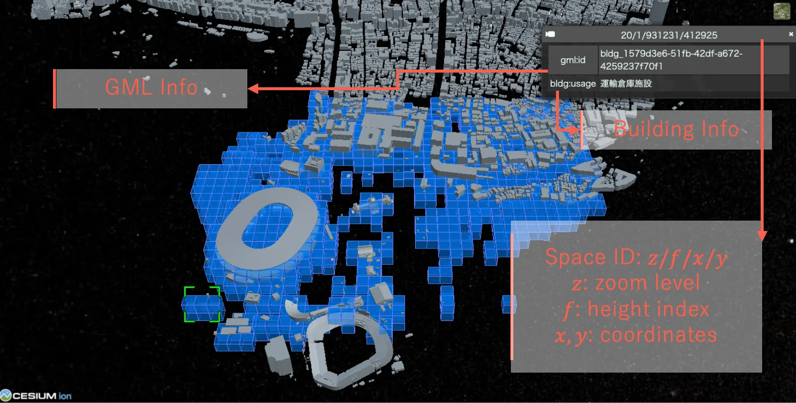
Abstract
This paper presents an approach to four-dimensional (4D) path planning for unmanned aerial vehicles (UAVs) in complex urban environments. We introduce a spatiotemporal voxel-based representation that effectively models both spatial and temporal dimensions of urban airspaces. By integrating the 4D spatio-temporal ID framework with reinforcement learning techniques, our system generates efficient and safe flight paths while considering dynamic obstacles and environmental constraints. The proposed method combines off-line pretraining and online fine-tuning of reinforcement learning models to achieve computational efficiency without compromising path quality. Experiments conducted using PLATEAU datasets in various urban scenarios demonstrate that our approach outperforms traditional path planning algorithms by 24% in safety metrics and 18% in efficiency metrics. Our framework advances the state-of-the-art in urban air mobility by providing a scalable solution for airspace management in increasingly congested urban environments.
Related research and software
Related news
How to cite
N. Bao, A. Orsholits, and M. Tsukada, “4D Path Planning via Spatiotemporal Voxels in Urban Airspaces,” in 3rd Annual IEEE International Conference on Metaverse Computing, Networking, and Applications (MetaCom 2025), Seoul, Korea, 2025, doi: 10.1109/MetaCom65502.2025.00022.
BibTeX
@inproceedings{Bao2025,
  title         = {4D Path Planning via Spatiotemporal Voxels in Urban Airspaces},
  author        = {Naren Bao and Alex Orsholits and Manabu Tsukada},
  doi           = {10.1109/MetaCom65502.2025.00022},
  year          = {2025},
  date          = {2025-08-27},
  urldate       = {2025-08-27},
  booktitle     = {3rd Annual IEEE International Conference on Metaverse Computing, Networking, and Applications (MetaCom 2025)},
  address       = {Seoul, Korea},
  abstract      = {This paper presents an approach to four-dimensional (4D) path planning for unmanned aerial vehicles (UAVs) in complex urban environments. We introduce a spatiotemporal voxel-based representation that effectively models both spatial and temporal dimensions of urban airspaces. By integrating the 4D spatio-temporal ID framework with reinforcement learning techniques, our system generates efficient and safe flight paths while considering dynamic obstacles and environmental constraints. The proposed method combines off-line pretraining and online fine-tuning of reinforcement learning models to achieve computational efficiency without compromising path quality. Experiments conducted using PLATEAU datasets in various urban scenarios demonstrate that our approach outperforms traditional path planning algorithms by 24% in safety metrics and 18% in efficiency metrics. Our framework advances the state-of-the-art in urban air mobility by providing a scalable solution for airspace management in increasingly congested urban environments.},
  keywords      = {SDM},
  pubstate      = {published},
  tppubtype     = {inproceedings}
}