
Geographic-Aware Network Analysis and Visualization for Cooperative Automated Driving
Master's thesis, Graduate School of Information Science and Technology, The University of Tokyo, Mar 31, 2023
Summary in three lines
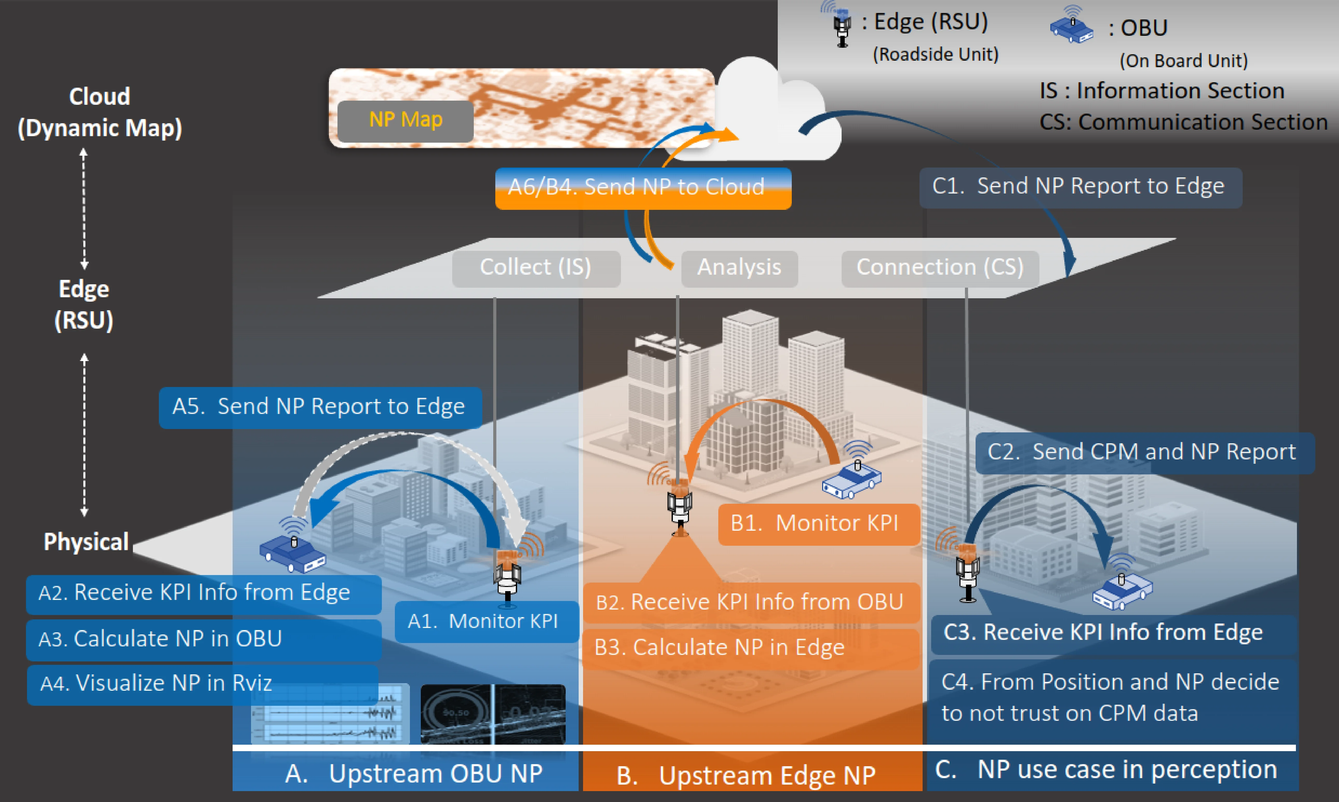
- The thesis links measurements of cooperative driving network performance to geography.
- It uses Autoware and DM2.0PF to store past measurements in the cloud and make them available to later vehicles.
- Outdoor tests show that past readings can provide a reference even when moving objects and interference change current conditions.
Figures from the paper
How to cite
K. Kambara, “Geographic-Aware Network Analysis and Visualization for Cooperative Automated Driving,” in Master's thesis, Graduate School of Information Science and Technology, The University of Tokyo, 2023.
BibTeX
@mastersthesis{Kambara2023Thesis,
  title     = {Geographic-Aware Network Analysis and Visualization for Cooperative Automated Driving},
  author    = {Koichi Kambara},
  year      = {2023},
  date      = {2023-03-31},
  urldate   = {2023-03-31},
  school    = {Master's thesis, Graduate School of Information Science and Technology, The University of Tokyo},
  keywords  = {ITS, Thesis},
  pubstate  = {published},
  tppubtype = {mastersthesis}
}