0%


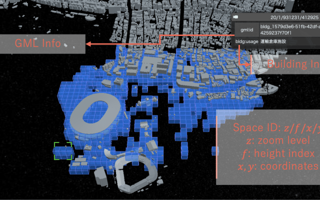
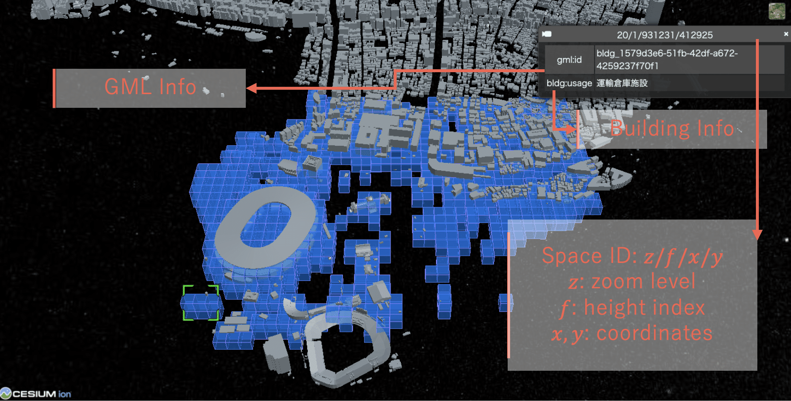
空間ID(Spatial ID)は、日本政府によって策定された標準仕様であり、物理空間を階層的な三次元ボクセルとして表現し、必要に応じて時間軸を拡張可能な枠組みです。各ボクセルには {z}/{f}/{x}/{y}(ズームレベル/高度/経度/緯度)の形式で計算可能な識別子が割り当てられ、地球規模(プラネタリースケール)から、サブメートル解像度(例:ZL28における約15cm)まで、一貫した空間アドレッシングを可能にします。空間IDは、静的・動的、空間・時間を問わない異種データを、アプリケーション固有のGIS処理ではなく、一般的なデータベース機構によってインデックス化・検索・統合することを可能にします。この点において、空間IDは単なる空間表現ではなく、大規模空間コンピューティングのための「アドレス可能でクエリ可能な基盤」として機能します。
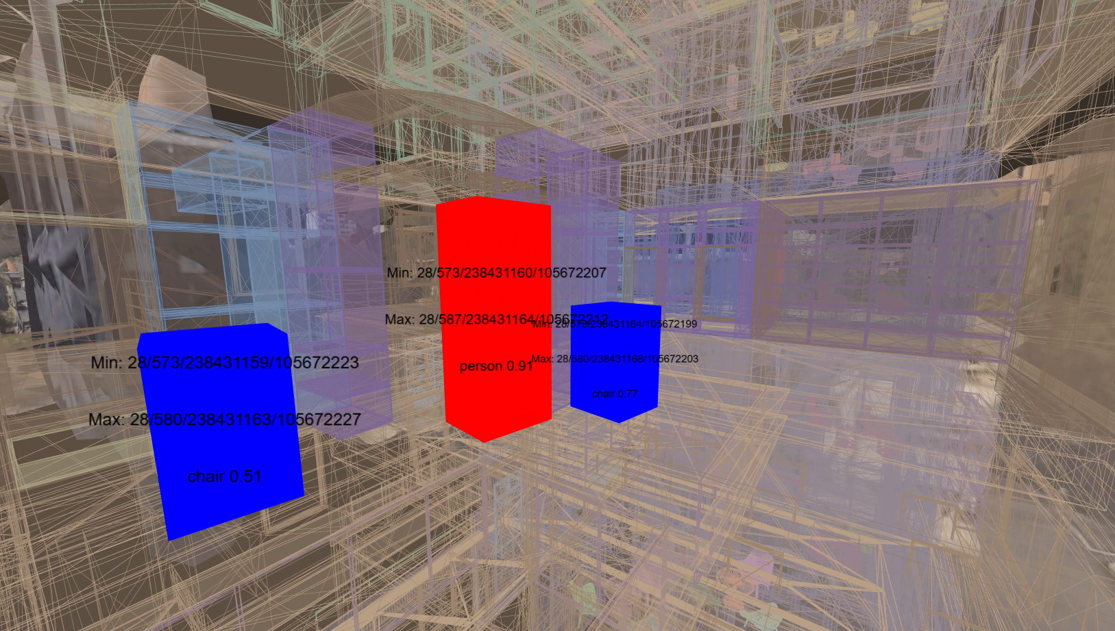
本研究の一つの方向性として、空間IDを空間オーサリングおよび参照のための仕組みとして活用し、Mixed Reality(MR)システムを物理空間とのインタフェースとして用いる研究を行っています。この研究では、空間IDが永続的なアンカーとして機能し、注釈、属性情報、センサ由来データといったデジタルコンテンツを実空間上の位置に結び付けます。これらの関連付けは分離型のデータベース構成によって管理され、柔軟な取得やクロスプラットフォームでの相互運用を可能にします。さらに、クラウドベースの認識パイプラインを統合し、その出力を対応する物理位置にMR上で可視化することで、空間IDが正確な空間整合、永続的なオーサリング、リアルタイムな検証・観察を支えることを示しています。この研究において、MRは空間IDに基づくデータを生成・検証・探索するためのインタフェース層として用いられています。
より大きなスケールでは、空間IDをリアルタイム都市データ基盤の中核となるインデックス層として運用する研究に取り組んでいます。プロジェクト PLATEAU に由来する静的な3D都市モデルは空間IDへと変換され、地理空間データベースおよびベクタータイルとして配信されます。一方、動的なIoTストリームはエッジ側でリアルタイムに空間IDへとエンコードされ、Publish/Subscribe方式を用いてクラウドサービスと同期されます。このエッジ・クラウド統合アーキテクチャにより、空間+時間からなる4次元データに対して、データベース的なクエリおよび購読型アクセスを実現し、Webベースおよび没入型クライアントからの低遅延な利用を可能にします。東京における都市規模の実運用を通じて、空間IDが静的・動的な都市データを、アプリケーションごとに分断されたパイプラインではなく、単一の運用基盤として統合できることを示しています。
今後の主な焦点は、都市規模においてほぼ瞬時のクエリ応答を可能とする高性能な空間IDデータベース基盤を構築し、公開インフラとして運用することです。この規模では、いくつかの課題が支配的になります。第一に、高ズームレベルではクエリ対象領域が拡大するにつれて空間IDの数が急激に増加し、比較的小さな領域拡張であっても、クエリ時間やI/Oが指数的に増大し得ます。そのため、高解像度かつ広域を対象とするクエリは、面積制約やクエリ方針を厳密に設けない限り現実的ではありません。第二に、データセット規模そのものが制約となります。東京23区のZL25における空間IDデータは生データで150GBを超えており、単一サーバでの運用は事実上不可能です。これに対応するためには、分散計算、適切なインデックス設計、インフラレベルでの設計が不可欠となります。最も難しい問題は、どのズームレベルでどのデータをクエリ可能にするかという設計です。建物や街区スケールでは有用な個別センサ位置や詳細メタデータも、都市・広域スケールのクエリにそのまま露出させると、膨大な件数の集約が必要となり、スケールしません。そのため、データ投入(インジェスト)の段階から、ズームレベルに応じたデータ可視性、集約、圧縮方針を組み込む必要があります。これらの課題に取り組むことは、空間IDを既存の計算基盤と親和性の高い、実用的かつ信頼できる空間インデックス基盤として確立する上で不可欠です。
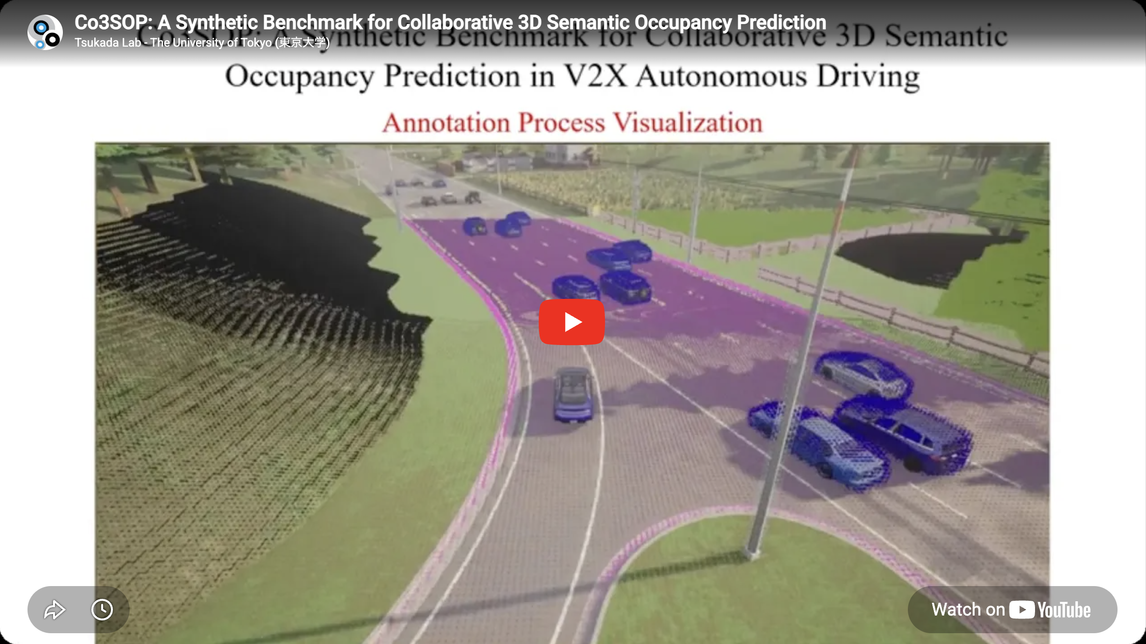
autonomous driving machine learning
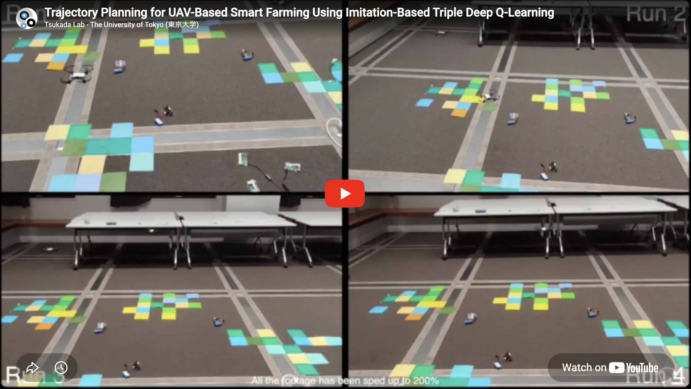
machine learning uav
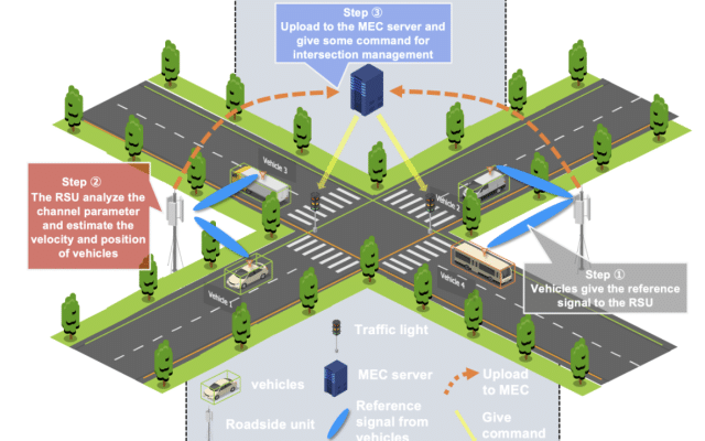
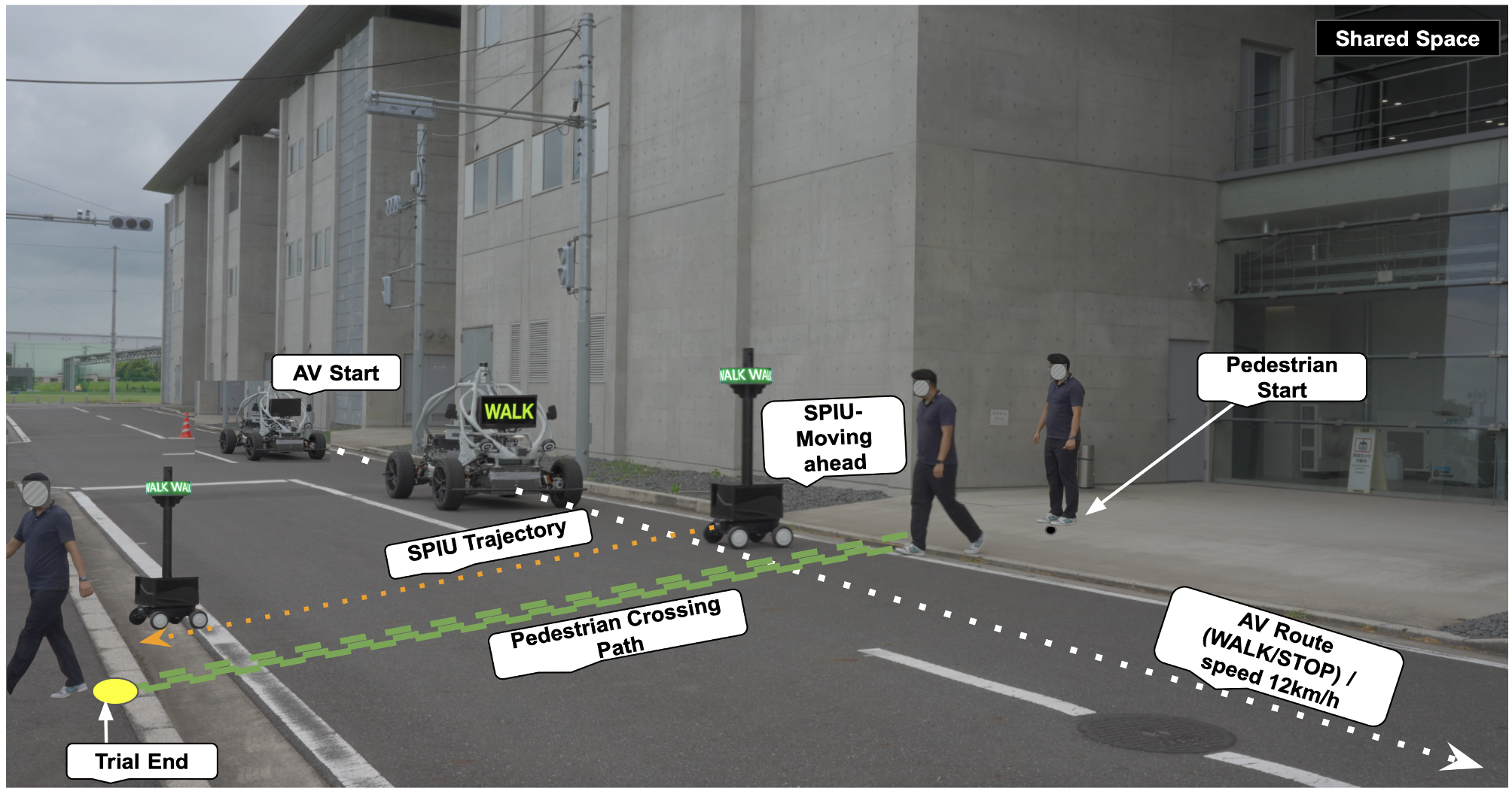
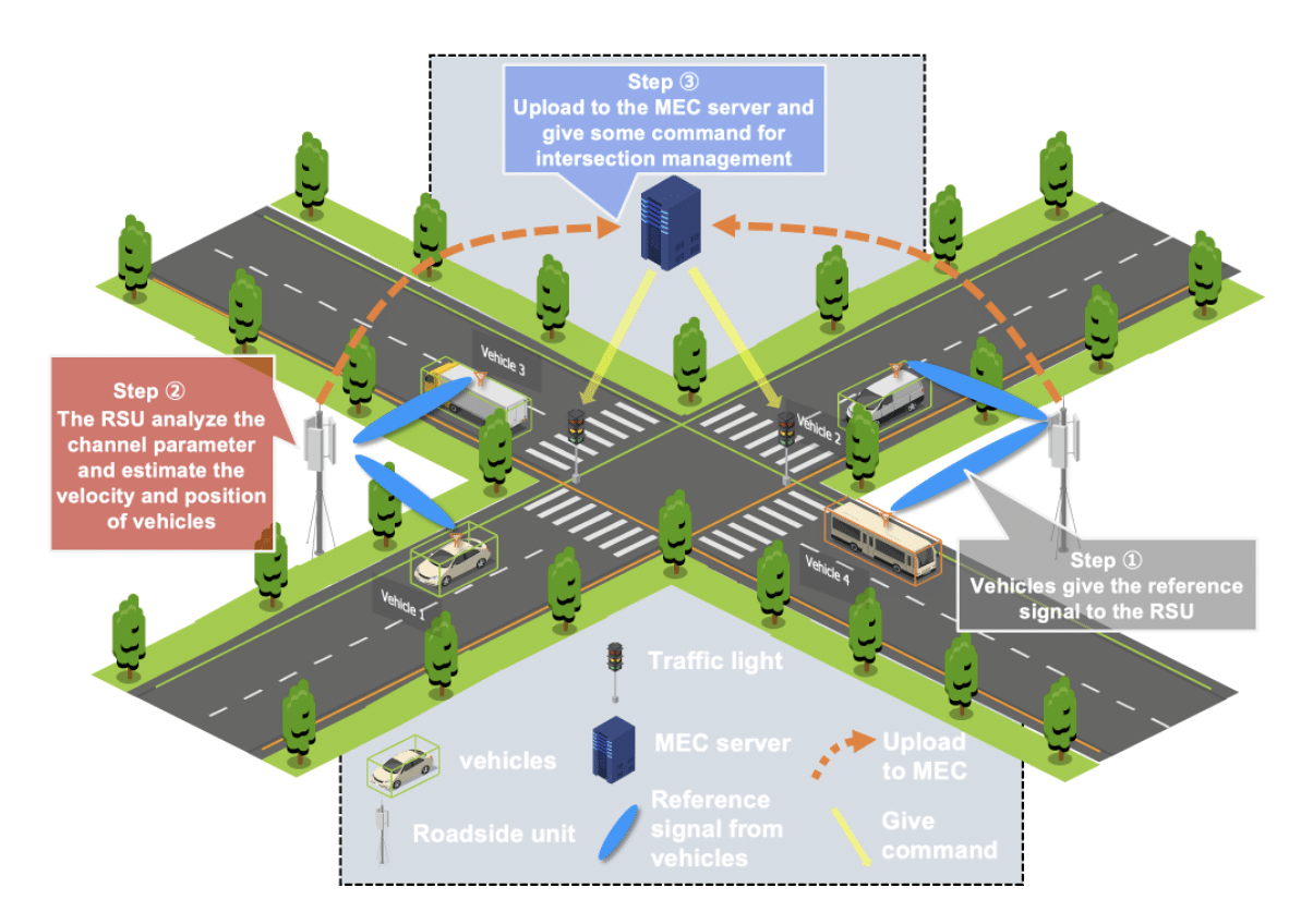
autonomous driving v2x

digital twins extended reality
digital twins uav

autonomous driving machine learning

machine learning v2x